-
Featured RSPO Palm Oil Mills
Certification of sustainable palm oil production is handled through the palm oil mill and its supply base. The certification includes plantations managed by the mill and plantations managed by other suppliers, including smallholders. To have its oil mill certified, a palm oil producer must show a...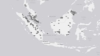
-
Urban areas in Kenya
This data was used in Map 1.3 and in other maps throughout Nature's Benefits in Kenya: An Atlas of Ecosystems and Human Well-Being. Original data are downloadable at www.africover.org.
-
Locations of sand beaches in Kenya
This data was used in Map 6.4 and Map 6.5 in Nature's Benefits in Kenya: An Atlas of Ecosystems and Human Well-Being. Original data are downloadable at www.africover.org.
-
Forest Types in Kenya, 2000
This data was used in Map 1.3 and Map 7.1 in Nature's Benefits in Kenya: An Atlas of Ecosystems and Human Well-Being. Original data are downloadable at www.africover.org.
-
Wetlands in Kenya
This data was used in selected maps in Nature's Benefits in Kenya: An Atlas of Ecosystems and Human Well-Being. Original data are downloadable at www.africover.org.
-
Bare areas (areas naturally devoid of vegetation) in Kenya
This data was used in Map 1.3 in Nature's Benefits in Kenya: An Atlas of Ecosystems and Human Well-Being. Original data are downloadable at www.africover.org.
-
Waterbodies in Kenya
This data was used in maps throughout Nature's Benefits in Kenya: An Atlas of Ecosystems and Human Well-Being. Original data are downloadable at www.africover.org.
-
Tree Plantations in Kenya
This data was used in Map 7.3 in Nature's Benefits in Kenya: An Atlas of Ecosystems and Human Well-Being.
-
Pineapple Plantations in Kenya
This data was used in Map 3.9 in Nature's Benefits in Kenya: An Atlas of Ecosystems and Human Well-Being. Original data are downloadable at www.africover.org.
-
Size of Agricultural Crops in Kenya
Used in Map 5.7 of Nature's Benefits in Kenya: An Atlas of Ecosystems and Human Well-Being. Original data are downloadable at www.africover.org.
-
Large-Scale Irrigation in Kenya
This data was used in Map 3.12 in Nature's Benefits in Kenya: An Atlas of Ecosystems and Human Well-Being. Original data are downloadable at www.africover.org.
-
Agricultural Areas in Kenya
This data was used in Map 1.3 in Nature's Benefits in Africa: An Atlas of Ecosystems and Human Well-Being. Original data are downloadable at www.africover.org.
-
Waterbodies in Uganda
This dataset results from the combination of three datasets: 1. NATIONAL FOREST AUTHORITY (NFA). 1996. Land Cover GIS Database. Kampala, Uganda: Government of Uganda, NFA. 2. NATIONAL IMAGERY AND MAPPING AGENCY (NIMA). 1997. Vector Map Level 0 (Digital Chart of the World), 3rd Edition....
-
Featured Protected areas
The World Database on Protected Areas (WDPA) is the most comprehensive global spatial data set on marine and terrestrial protected areas available. Protected area data are provided via Protected Planet, the online interface for the World Database on Protected Areas (WDPA). The WDPA is a joint...
-
Featured Intact Forest Landscapes (2013)
"The Intact Forest Landscapes (IFL) data set identifies unbroken expanses of natural ecosystems within the zone of forest extent that show no signs of significant human activity and are large enough that all native biodiversity, including viable populations of wide-ranging species, could be...
-
Featured Aqueduct Global Flood Risk Maps
For the current scenario, we used hydrological data from 1960 through 1999 for generating flood inundations for 9 return periods, from 2-year flood to 1000-year flood, and 2010 GDP, population, and land use data for assessing flood impacts. For future projections, we used 5 GCMs (Global Climate...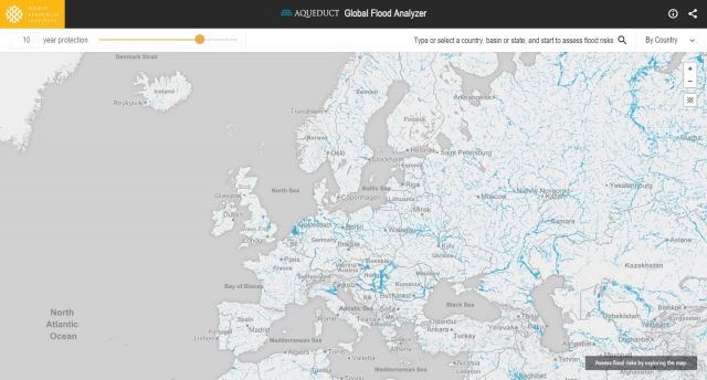
-
NWIS 1997 Data (Uganda)
Some data were used in maps 4, 5, 6, 7, 8, 9, 10 of ""Mapping a Better Future: How Spatial Analysis Can Benefit Wetlands and Reduce Poverty in Uganda."" from Wetlands Management Department, Ministry of Water and Environment, Uganda; Uganda Bureau of Statistics; International Livestock Research...
-
Tropical Coral Reefs of the World (500-m resolution grid)
Global map of shallow, tropical coral reefs, gridded at 500-m resolution for use in the Reefs at Risk Revisited project. The coral reef location data were compiled from multiple sources by UNEP-WCMC, the WorldFish Center, and WRI. To standardize these data for the purposes of the Reefs at Risk...
-
Kenya Digital Elevation Model (90m resolution)
The objective of the SRTM mission is to obtain elevation radar data on a near-global scale and generate the most complete high-resolution digital topographic database of the Earth. The information collected by SRTM will be used to provide a tool to enhance the activities of scientists, the...