-
Average water consumption of livestock and wildlife by sub-basin in Kenya, 19...
WRI/ILRI calculation based on animal data from DRSRS 2003; Grunblatt et al. 1995, 1996; and daily water requirements for selected species from MoWD and JICA 1992, Peden at al. 2003, 2004. This data was used in Map 3.13 in Nature's Benefits in Kenya: An Atlas of Ecosystems and Human Well-Being.
-
Featured Aqueduct Global Flood Risk Maps
For the current scenario, we used hydrological data from 1960 through 1999 for generating flood inundations for 9 return periods, from 2-year flood to 1000-year flood, and 2010 GDP, population, and land use data for assessing flood impacts. For future projections, we used 5 GCMs (Global Climate...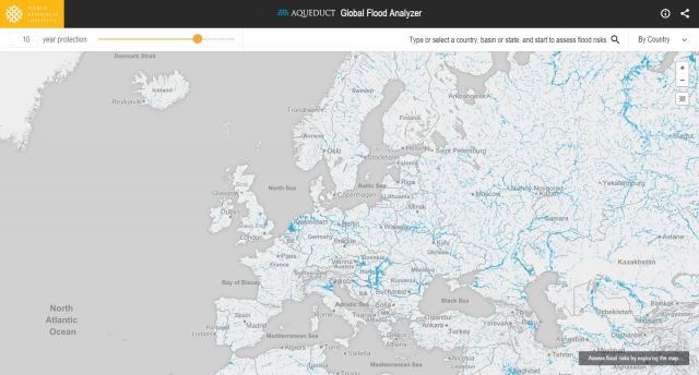
-
Land Use in Selected Indian Cities
The dataset comprises eleven series of land use/land cover (LULC) maps, each corresponding to one city in India—Ahmedabad, Belgaum, Hindupur, Hyderabad, Jalna, Kanpur, Parbhani, Pune, Singrauli, Sitapur, or Vijayawada—and containing one map per year for 2015–2018. Every map contains several...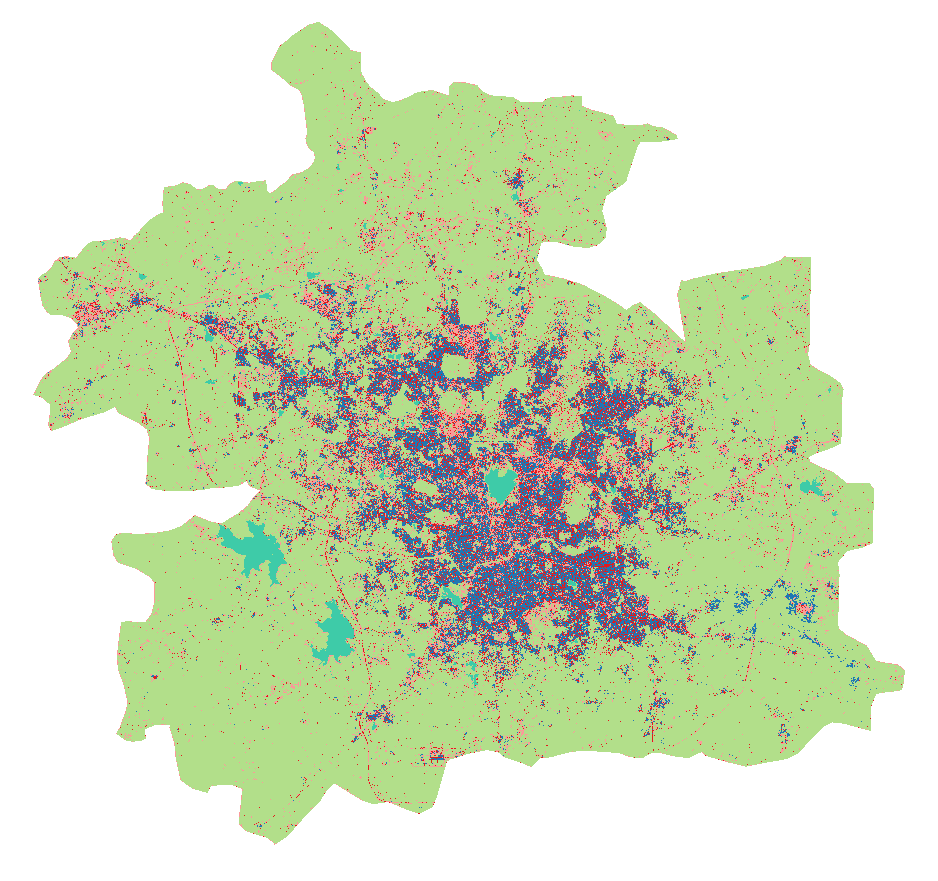
-
Supplementary Materials for "State of the Nationally Determined Contributions...
This dataset presents information on the adaptation components of 86 countries’ NDCs submitted until June 30, 2021, in association with the working paper State of the Nationally Determined Contributions: Enhancing Adaptation Ambition. Nine NAPs submitted by the 86 countries during this time frame...
-
Dataset of U.S. School Bus Fleets
This dataset contains detailed information on the composition of school bus fleets in the United States. It dataset contains data from 46 states and the District of Columbia, though the specific data available vary by state. For most states, the dataset includes bus-level information, such as the...
-
Local Government Renewables Action Tracker
The Tracker contains information on two types of renewables activities commonly being pursued by local governments in the United States: 1. Electricity purchases and transactions, such as on-site solar, community solar projects, off-site power purchase agreements (PPAs), and green tariff...
-
Bleaching observations (1963-2010)
This dataset was used as base data in Reefs at Risk. Point locations of reported observations of coral bleaching between 1963 and 2010. This dataset was built upon an original bleaching database developed at UNEP-WCMC, and has been maintained and updated regularly by ReefBase since early 2002.
-
Average Annual Rainfall in Kenya
This data was used in Map 3.1 in Nature's Benefits in Kenya: An Atlas of Ecosystems and Human Well-Being.
-
World's Average Monthly Rainfall in November
This data was used in Map 3.5 in Nature's Benefits in Kenya: An Atlas of Ecosystems and Human Well-Being.
-
World's Average Monthly Rainfall in July
This data was used in Map 3.4 in Nature's Benefits in Kenya: An Atlas of Ecosystems and Human Well-Being.
-
World's Average Monthly Rainfall in April
This data was used in Map 3.3 in Nature's Benefits in Kenya: An Atlas of Ecosystems and Human Well-Being.
-
World's average monthly rainfall in February
This data was used in Map 3.2 in Nature's Benefits in Kenya: An Atlas of Ecosystems and Human Well-Being.
-
Shipping Activity
This dataset was used as base data in Reefs at Risk. Shipping activity data used in the model of threat to coral reefs from marine-based pollution and damage in the Reefs at Risk Revisited project. This dataset was derived at WRI from the World Meteorological Organization Voluntary Observing...
-
Reefs at Risk Revisited (Social Vulnerability Data)
This shapefile features the Exclusive Economic Zones (EEZs) for 108 coral reef countries and territories classified according to an index of their reef dependence, adaptive capacity, and social vulnerability. Results are presented as quartiles, with 27 countries/territories classified in each of...
-
Reefs at Risk Revisited (Local Threats Data)
Threats from coastal development, marine-based pollution and damage, overfishing and destructive fishing, and watershed-based pollution were analyzed separately. These threats were integrated into the Integrated Local Threat index. Past thermal stress was integrated with local threats into the...
-
WRI Ross Center for Sustainable Cities’ Water and Sanitation 15-City Study
To address the absence of comparable city-level water data, this dataset compiles data from 15 global South cities located in sub-Saharan Africa, South Asia, and Latin America and among the regions that are the focus of the World Resources Report (WRR) "Towards a More Equal City". The 15 cities...
-
Featured Dataset of Electric School Bus Adoption in the United States
Transitioning to electric school buses (ESBs) from traditional diesel-powered school buses can reduce students’ exposure to air pollution and decrease greenhouse gas emissions. School districts and private fleet operators around the United States are adopting electric school buses with increasing...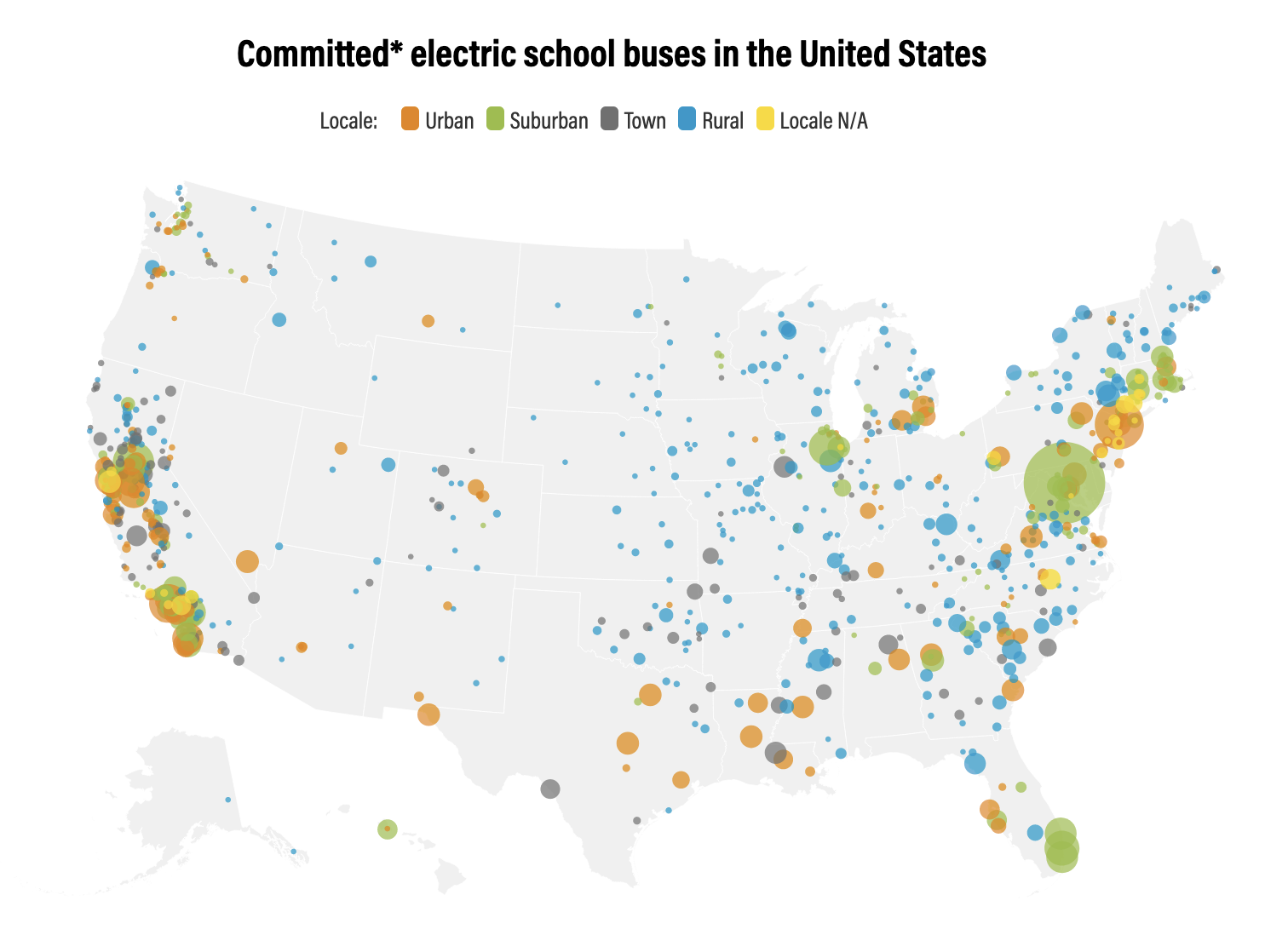
-
Tropical Coral Reefs of the World (500-m resolution grid)
Global map of shallow, tropical coral reefs, gridded at 500-m resolution for use in the Reefs at Risk Revisited project. The coral reef location data were compiled from multiple sources by UNEP-WCMC, the WorldFish Center, and WRI. To standardize these data for the purposes of the Reefs at Risk...
-
Digital Globe GEO1 Satellite Imagery
Effective emergency planning and response requires quick and easy access to accurate, up-to-date information. DigitalGlobe’s FirstLook is an online subscription service for emergency management that provides fast web-based access to pre-and post-event imagery of world disasters delivered to...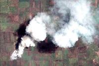
-
Digital Globe QB01 Satellite Imagery
Effective emergency planning and response requires quick and easy access to accurate, up-to-date information. DigitalGlobe’s FirstLook is an online subscription service for emergency management that provides fast web-based access to pre-and post-event imagery of world disasters delivered to...